Friday, January 20, 2006

Kyushu Climbing, or, How to Exploit Your Time in Japan from 40 feet above It

This post is intended as both a summary of my climbing experiences in Kyushu and a guide for future climbers who might end up here*. It assumes that the climber is based in Saga-ken, Japan.

Most rock climbing areas in Kyushu offer single pitch sport routes. For those living in Saga-ken, there are several rock climbing areas that are easily accessible. With the exception of the rainy season, you can climb all year. Japanese climbers are generally sociable and safety conscious. Climbing gear can be purchased at Base Camp in Saga City (west of kencho on Route 207). Unless otherwise noted, each crag is some type of metamorphic rock.

Nodake
Nodake is located in Nagasaki-ken, between the city of Omura (Nagasaki-ken) and Kashima (Saga-ken). A small mountain road off Route 444 provides access. Nodake has routes ranging from 5.7 to 5.13 in difficulty. The biggest concentration of climbs is in the 5.11 range. All routes are bolted and the rock is generally of good quality. Shade cover abounds and some routes can be climbed even when it’s raining. Water available.

Ryutosen
Ryutosen
Ryutosen is located in Nagasaki-ken. It’s only a 20-minute drive from the town of Ureshino, Saga-ken. It’s another sport climbing area with a concentration of difficult 5.11 and 5.12 climbs. Four separate climbing areas exist. Great swimming in a waterfall-fed series of pools. Bring water.

Taku High School
Taku High School has an outdoor climbing wall as well as an indoor bouldering gym. The wall is open to the public free of charge on Wednesday and Friday evenings. You’ll need to bring your own rope.

Azumaya
Azumaya is a small climbing area with a dozen short routes. Most of the routes are characterized by dime ledges that require precise edging and painful crimping. It’s close to anyone living in eastern Saga. Bring water.

Hiraodai
This is a small climbing area outside of Kitakyushu-shi. There are about 25 routes here. Because of the lack of shade cover, climbing here in the summer is not recommended. The rock is a coarse limestone; expect abrasions on the hands especially. Lots of cracks, holes, chicken heads, and other features. Also bouldering nearby. There is also a famous cave here that you can enter for a small fee. Bring water.

Hyugami
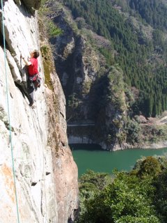
Hyugami is located in Fukuoka-ken, near the border with Oita-ken. It’s about 25 kilometers from the town of Yame on Route 442. Hyugami has several distinct climbing areas consisting of single and multi-pitch sport routes, slabs and aid routes (fixed pro). Be careful, as some of the pro dates back to the 80s (and beyond!). There’s an abandoned campsite that climbers use to spend the night. Bring water.

Honjo
Honjo
This limestone climbing area is located in southern Oita-ken. There are a total of four climbing areas totaling about 100 routes. Solid range from beginner to advanced, but definitely heaviest in the 5.11 and 5.12 range. The rock is a bit chalky but is good quality, with lots of holes, cracks, and other features. Good swimming during the summer. Great onsen nearby for those cold nights. Bring water.

Hachimenzan
Hachimezan can be found outside of Nakatsu-shi in northern Oita ken. There are three climbing areas, two of which face the south (lots of sunshine = good for winter, bad for summer). There are about 100 routes in total, the majority of which are rated in the 5.10s and 5.11s. Hard rock but not painful on the hands. Bouldering is also possible at several other locations on the mountain. Some spring water available but not guaranteed.

Hiezan, Okue-san and Hokodake
These areas are in the Shishigawa Valley (pop. 60) in central Miyazaki-ken, not far from Nobeoka-shi. It is quite possibly the most beautiful place in all of Kyushu. These are multi-pitch alpine routes and should only be attempted by those who have done this style of climbing. Better yet, go with someone who’s climbed here before. Expect fewer bolts and questionable anchors. Rock is granite and of great quality(For a trip report, click here: http://strandedontheisledekyushu.blogspot.com/2005/09/ascent-of-hiezan.html). Great swimming and hiking is possible as well. Water is available and some food (a bit pricy) can be bought at the only grocery store in 20km. Might be a good idea to bring your own food in case they decide to close early or not open at all.
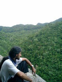
Kiara, near the summit of Hokodake

Other
This guide is by no means comprehensive. There are rumors of decent sport climbing in Kagoshima. Yakoshima, off the coast of southern Kagoshima, has some hardcore multi-day alpine routes. Kumamoto supposedly has some great bouldering, as does parts of Fukuoka. If you have any details on these areas that you’d like to share, or if you need more specific beta, please contact me by leaving your e-mail address in the comments section.

*Disclaimer: Rock climbing is inherently dangerous. Stupid people die stupid deaths. You and you alone (i.e. NOT ME) are responsible for your safety while climbing here in Kyushu or anywhere else. Climb hard, but climb at your own risk.

Malaysia Part I: Kota Kinabalu etc.


Every December, I take a trip to somewhere in Southeast Asia. This year I decided to visit Malaysia with my old friend Kathlyn and her boyfriend Dan. Our initial plan was to sport climb the numerous limestone crags on Peninsular Malay, but we then discovered Mt. Kinabalu in the Malaysian Borneo state of Sabah. Standing at 13, 435 feet, Kinabalu, which is actually the collective name of a number of 12,000 plus foot peaks, is the highest point in SE Asia. This spectacular draw was complimented by the surrounding countryside and islands which offered decent snorkeling, picturesque beaches, white water rafting, and road tripping activities. For purposes of clarity, I'm dividing this trip report into two separate posts, off-mountain and on-mountain.

Off Mountain

I arrived at the Borneo Backpackers Lodge at 2am on December 28 and met Kathlyn who had been waiting a number of hours for my delayed flight. After a quick meal we hit the sack.

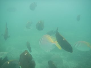
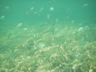
The next day we arranged travel to Mamutik and Manukan, two of the five islands that make up Tunku Abdul Rahman Park. Though initially disappointed with the former, we soon found a small coral garden just off the sometimes littered beach. Though not especially colorful, the coral did yield a surprising variety of sea life. We would return to snorkel here two more times, each time discovering creatures we had missed on our previous visit. Yes, we did find Nemo, about a million times in fact, though he was a bit camera shy. Here are some of his friends.


A more interesting discovery was the moray eel curled up inside a piece of coral that our friend Todd spotted.


I also saw a four foot long poisonous sea snake but didn't have the camera with me. I was scared of the thing anyway.

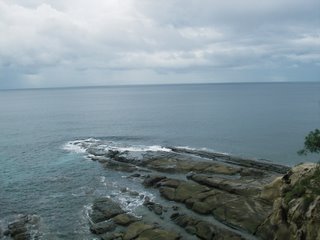
On the third day of our trip we rented a small car and drove to the northernmost point of Borneo. Aptly named "The Tip of Borneo", this small peninsula is the dividing point between the Suluman and South China Seas. Though we weren't there to witness it, supposedly the differences in the two seas is visible at low tide, making it obvious that they are indeed separate bodies of water despite the lack of anything to physically bisect them. Wild.


The white sand beaches leading up to the Tip(visible behind Kathlyn) were serene, hearkening back to a time before tourism reached the majority of SE Asia.

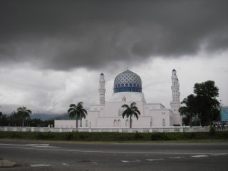
Though Malaysia is a surprisingly tolerant melting pot of cultures and faiths (making it an anomaly in this part of the world), Muslims are the single largest religious group. Our mini-road trip took us past one of many stunning mosques.

We brought in the New Year in a club catering to upper class college kids, mostly of Chinese descent. Morning brought a predictable hangover which would accompany us throughout the day. Unfortunately, this was also the day that we set out for Mt. Kinabalu, a three hour ride up windy mountain roads in a mini-bus with less than adequate shocks. We arrived at the lodge around sunset and spent the rest of the evening preparing our gear for the next day's hike up the mountain.

Wednesday, January 11, 2006

December Parties

December is party time in Japan. There are the traditional bonenkai, Christmas gatherings, and what not. Here are a few pics from two of the parties I attended last month. Let me apologize in advance for waiting several weeks to post this; I was in Malaysia til January 10.

English Club bonenkai/Christmas party:

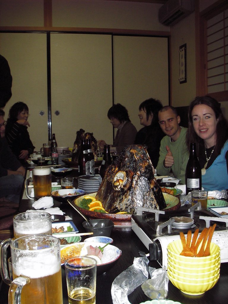
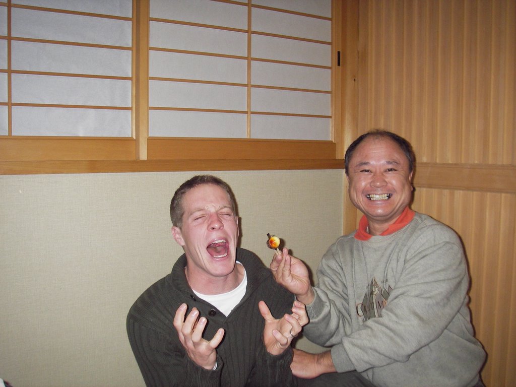
This was held at sushihide restaurant in Ariake-cho on December 17. We were expecting nabe, which is basically a communal soup pot that people add food to from various platters. They did have this cuisine, but they also had two massive mackerel tuna heads. These things stood about a foot high from gills to mouth, as seen below. This other shot is of Kawa-chan, who felt compelled to eat the fish's eyeball, much to the delight of culture-shocked Peter.


Christmas Eve Feast

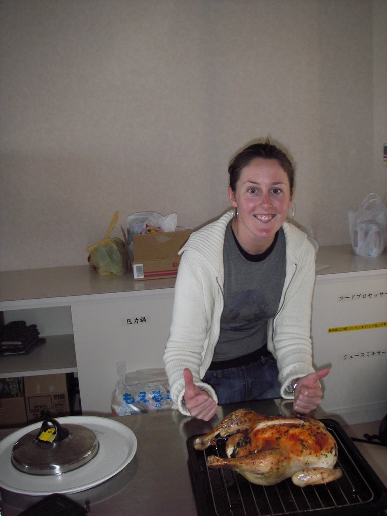
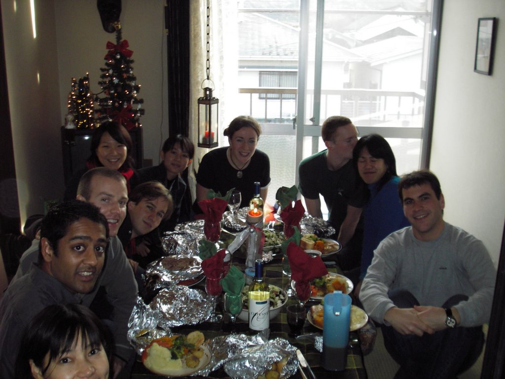
It had been two years since I'd had a semi-proper Christmas dinner. It was also the first time that I was in Japan over the Holidays (am usually in Thailand, dodging tsunamis or getting ecoli poisoning). So, myself and a few other ALTs decided to rent out the local community center's kitchen and cook ourselves up some grub. A diverse group of ten or so attended, hailing from Japan, the U.S. New Zealand, England, Ireland, and Canada. As turkeys are hard to come by here in Japan, we settled for three chickens which we stuffed with a spinach-herb concoction and then baked for several hours. Now, I've had some decent stuffing in my day, but this recipe was top shelf. Really delicious. We also feasted on pumpkin soup, garlic bread, garlic mashed potatoes, roasted potatoes, greek salad, Christmas pudding (like cake; it's an English thing...), and copious amounts of wine and beer. There was brandy too, supposedly an ingredient in the pudding (again, English), but that mysteriously disappeared before anything could be done with it. Despite this, the dinner was a smashing success. Thanks to everyone for helping out, especially Aine, who volunteered her house for the event.

Kate with one of the lucky birds.

Group shot

Friday, November 11, 2005

Out n' About in Shiroishi

I live in Shiroishi town, a small farming and fishing community in southern Saga-ken. Until the January 1, 2005 consolidation of muncipalities (a.k.a. gappei) , my town was known as Ariake, a much nicer name I think. Besides, Shiroishi always smells like cow manure. But alas------- I too am now a resident of Shiroshi, a victim of Tokyo's drive for greater centralization of power. The long term plan is to merge, merge, merge: small towns (like my dear Ariake) join with surrounding towns, large towns merge to form cities, and prefectures merge to form states. If all goes as planned Saga-ken will only be a district within Kyushu and the already democratically challenged Japanese will have that much less direct representation in government. Anyone feel like a return to feudalism?

The upshot is that my town is now larger and has more attractions that I can take pride in. This post will include a few of these diamonds in the rough.

#1 Inasa Shrine
Maintained for generations by the Inasa family, this shrine is located on its namesake mountain, Inasa-yama. Though not as grand nor as famous as nearby Yoshinogari Shrine, Inasa Shrine is an unprententious and serene setting. Plain stone foundations (no cement), unpainted wood buildings, and 300 year old trees recall a Japan that is largely lost in the garish cityscapes of today's Tokyo and Osaka.


#2 Sakuranosato
A kilometer of cherry tree lined-road leads to this magnificent look point. The shores of Kumamoto and even Mt. Aso are visible on a clear day, and even hazy days provide a bird's eye view of the local estuary and mud flats on the shores of the Ariake Sea.

#3 Gata (Mud Flats) and Ariake Sea

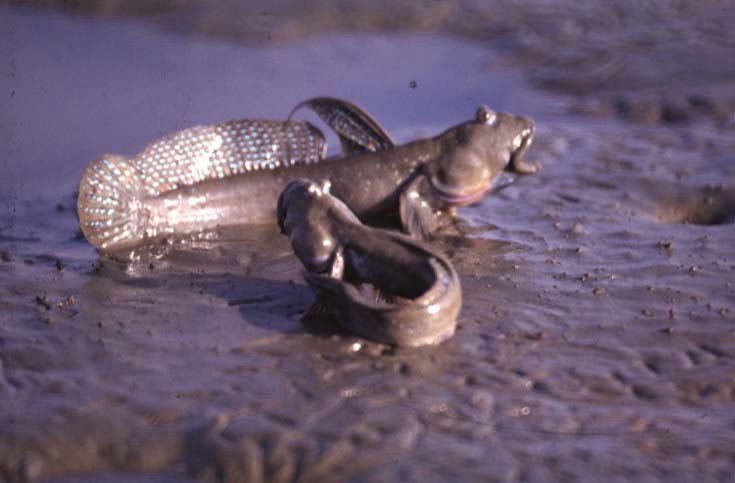
As mentioned above, the shores of the Ariake Sea contain what's known as gata, literally meaning "more mud than water". Despite a rather putrid odor, the gata supports a variety of sea life, the most famous of which is mutsugoro, or mud-skipping fish (see below). Here's a link to an interesting piece on the mutsugoro and the threats facing it: http://www.zmag.org/content/showarticle.cfm?SectionID=17&ItemID=6465. Also, you can eat these things. They're very crunchy when grilled.

Sunday, November 06, 2005

Hiking Sobo-san


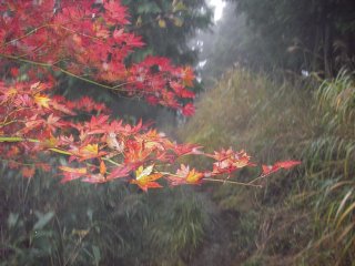
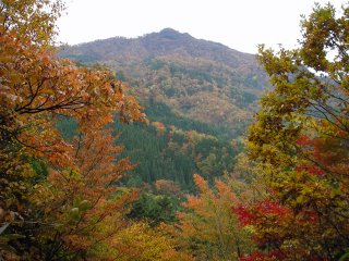
Sobo-san is the tallest mountain in the range that divides Miyazaki, Kumamoto, and Oita prefectures. My friend Andrew and I had planned on a 3 day backpacking trip over Sobo and several other mountains last week. However, typical of Japanese weather reports for national holidays, it rained long and hard instead of not at all (my friend Steve and I honestly believe that the government lies about the weather so that people will still spend money travelling, thereby proving a micro-burst of economic stimulation). I don't mind hiking in the rain, but I detest going to bed and waking up damp. Conclusion? Jump ship. Our 3 day trip turned into a mere day hike. Damn you Sobo!!!

Well, at least I got some good photos of the changing leaves.

Sunday, October 16, 2005

Not all bears bite


Left: Dad, Pyramid Point.

Right: My dad and brother.


Left: The "Sleeping Bear", along with Lake Michigan and South Bar Lake.


Sleeping Bear Dunes National Lakeshore is in the northwest corner of Michigan, not far from Traverse City. The name comes from a Chippewa legend about a mother bear and her two cubs. That story, and other information about the Park is nicely summarized in this article from wikipedia: http://en.wikipedia.org/wiki/Sleeping_Bear_Dunes_National_Lakeshore

As said, I was able to get up there for a few days while I was home last month. Since I was kid, my family has been coming to this area to hike the dunes forests, swim the inland lakes, and canoe and kayak the Platte and Crystal rivers. My dad, brother, and I, along with 10 other people and a flight attendent with a morose but hilarious sense of humor, flew from O'Hara to Traverse City in a mere 45 minutes, a far cry from the six hour drive that usually gets us there. Unfortunately, Mom couldn't make it up this time.


Though these are some spectacular pictures, they don't do the ever changing sand dunes and inland lakes justice. Only a visit can achieve that.


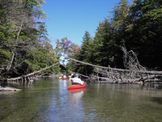
Kayaking the Crystal River.

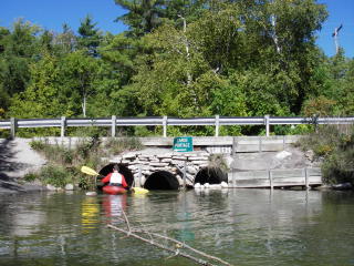
Portage.

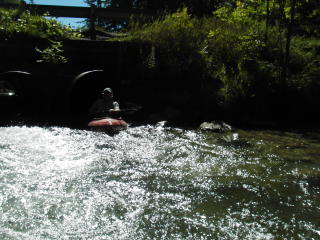
And the other side.


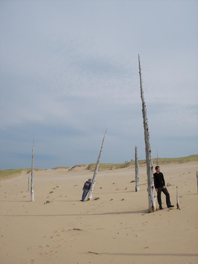
The cover shot for my upcoming album.

Lake Michigan. Yes, it might as well be an ocean.

Parting Shot


Thursday, October 13, 2005

Sweet Home Chicago

I was lucky enough to get home for a couple weeks in September. While there, I gorged myself on pizza, a variety of beer, and Spanish, French, Thai, Mexican, and Italian cuisine. I also checked out some Japanese restaurants, though I found once again that the proprieters were Korean (ironic given that most Koreans continue to hate the Japanese because of acts of brutality committed beford and during WWII, not to mention Japanese failure to atone for said atrocities). The Chicago Art Institute, a walking architectual tour of downtown, a Cubs game in Milwaukee, cycling in Bussee Woods and along the Fox River Trail, boating on Lake something-or-other in nearby Wisconsin, a four day trip to the Sleeping Bear National Lakeshore in NW Michigan.......it was a spectacular but busy "vacation". The best part was just be able to hang out with my family and friends. Good company really does make a place. Below are some choice pics.


Above right: The domed roof of the Chicago Cultural Center, initially built as a public library in the late 19th-century.

Above left: The Chicago Art Institute, one of the finest of its kind in the known world.


Above: This shot doesn't warrant inclusion without an explanation. Named for the foul smelling plants that covered the banks of the Chicago river prior to the European invasion, "Chicago" literally means "land of stinking onions" in the local Native American language (Illini? Miami?). This fence surrounds a ventilation shaft of some sort. If you follow the vertical poles down towards the sidewalk, you'll see that they seem to sprout from an onion-like bulb, representing the land of stinking onions that we all know and love.


Right: Me and The Gregory, Cubs v. Brewers, Millers Stadium, Milwaukee. Cubbies won. Holy cow.

Right: My father, John, cycling on the Fox River Trail.

Old friends.

Looks like the Sleeping Bear Dunes portion of my report will have to wait. It's simply too rich a subject to for today. We build up to things like that....