Friday, November 11, 2005

Out n' About in Shiroishi

I live in Shiroishi town, a small farming and fishing community in southern Saga-ken. Until the January 1, 2005 consolidation of muncipalities (a.k.a. gappei) , my town was known as Ariake, a much nicer name I think. Besides, Shiroishi always smells like cow manure. But alas------- I too am now a resident of Shiroshi, a victim of Tokyo's drive for greater centralization of power. The long term plan is to merge, merge, merge: small towns (like my dear Ariake) join with surrounding towns, large towns merge to form cities, and prefectures merge to form states. If all goes as planned Saga-ken will only be a district within Kyushu and the already democratically challenged Japanese will have that much less direct representation in government. Anyone feel like a return to feudalism?

The upshot is that my town is now larger and has more attractions that I can take pride in. This post will include a few of these diamonds in the rough.

#1 Inasa Shrine
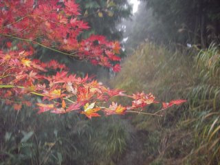
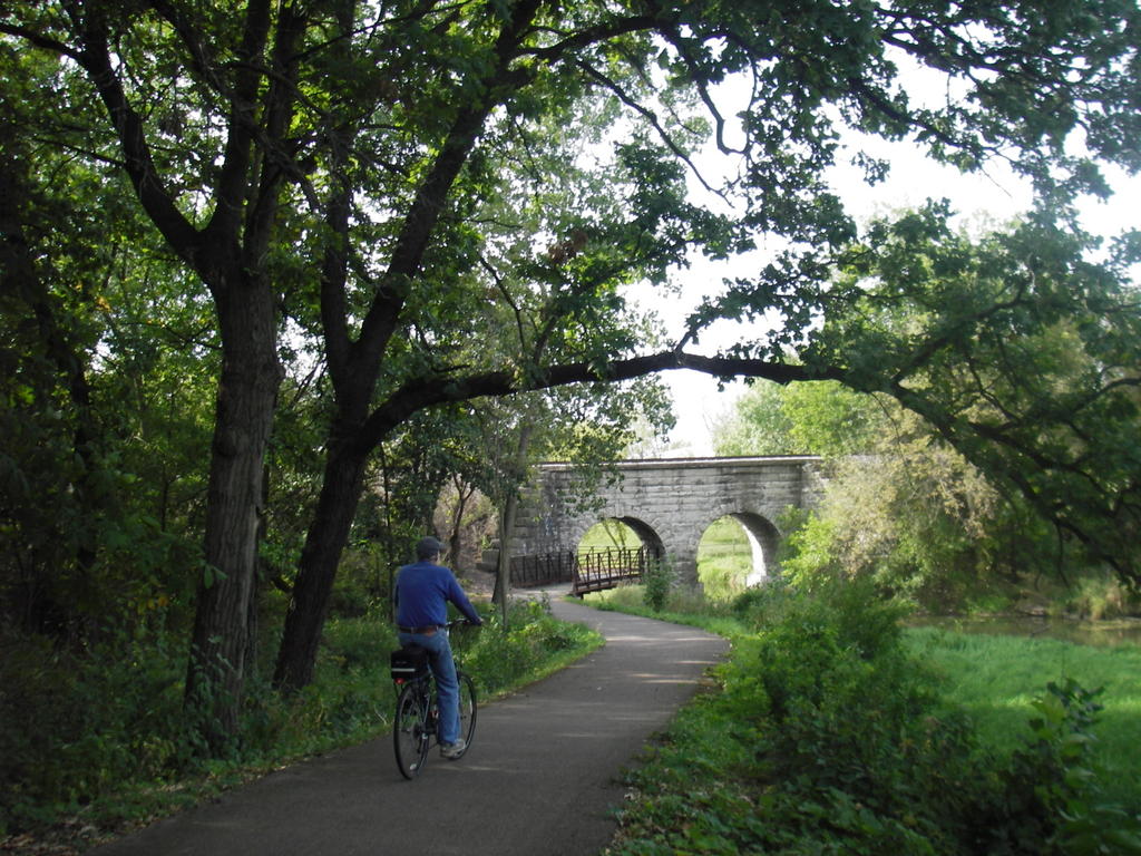
Maintained for generations by the Inasa family, this shrine is located on its namesake mountain, Inasa-yama. Though not as grand nor as famous as nearby Yoshinogari Shrine, Inasa Shrine is an unprententious and serene setting. Plain stone foundations (no cement), unpainted wood buildings, and 300 year old trees recall a Japan that is largely lost in the garish cityscapes of today's Tokyo and Osaka.
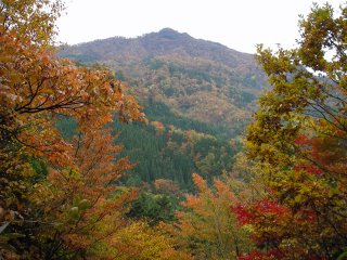
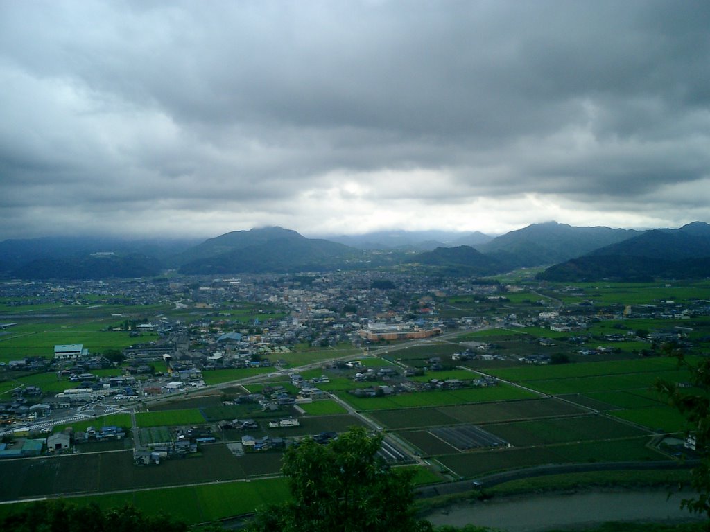


#2 Sakuranosato
A kilometer of cherry tree lined-road leads to this magnificent look 
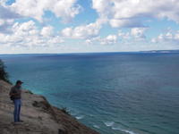
point. The shores of Kumamoto and even Mt. Aso are visible on a clear day, and even hazy days provide a bird's eye view of the local estuary and mud flats on the shores of the Ariake Sea.

#3 Gata (Mud Flats) and Ariake Sea

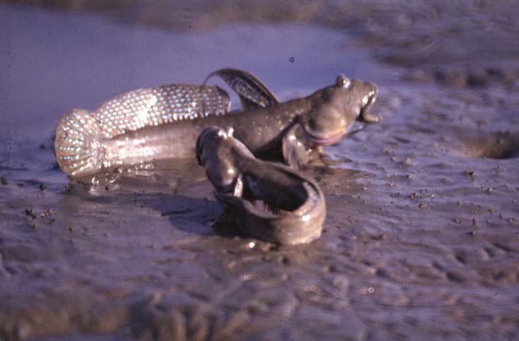
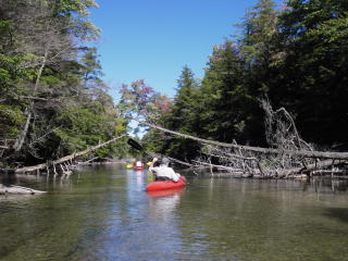
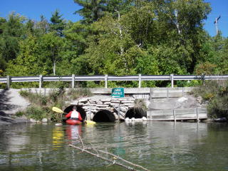
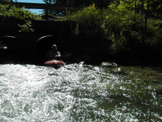
As mentioned above, the shores of the Ariake Sea contain what's known as gata, literally meaning "more mud than water". Despite a rather putrid odor, the gata supports a variety of sea life, the most famous of which is mutsugoro, or mud-skipping fish (see below). Here's a link to an interesting piece on the mutsugoro and the threats facing it: http://www.zmag.org/content/showarticle.cfm?SectionID=17&ItemID=6465. Also, you can eat these things. They're very crunchy when grilled.

Sunday, November 06, 2005

Hiking Sobo-san


Sobo-san is the tallest mountain in the range that divides Miyazaki, Kumamoto, and Oita prefectures. My friend Andrew and I had planned on a 3 day backpacking trip over Sobo and several other mountains last week. However, typical of Japanese weather reports for national holidays, it rained long and hard instead of not at all (my friend Steve and I honestly believe that the government lies about the weather so that people will still spend money travelling, thereby proving a micro-burst of economic stimulation). I don't mind hiking in the rain, but I detest going to bed and waking up damp. Conclusion? Jump ship. Our 3 day trip turned into a mere day hike. Damn you Sobo!!!

Well, at least I got some good photos of the changing leaves.

Sunday, October 16, 2005

Not all bears bite


Left: Dad, Pyramid Point.

Right: My dad and brother.


Left: The "Sleeping Bear", along with Lake Michigan and South Bar Lake.


Sleeping Bear Dunes National Lakeshore is in the northwest corner of Michigan, not far from Traverse City. The name comes from a Chippewa legend about a mother bear and her two cubs. That story, and other information about the Park is nicely summarized in this article from wikipedia: http://en.wikipedia.org/wiki/Sleeping_Bear_Dunes_National_Lakeshore

As said, I was able to get up there for a few days while I was home last month. Since I was kid, my family has been coming to this area to hike the dunes forests, swim the inland lakes, and canoe and kayak the Platte and Crystal rivers. My dad, brother, and I, along with 10 other people and a flight attendent with a morose but hilarious sense of humor, flew from O'Hara to Traverse City in a mere 45 minutes, a far cry from the six hour drive that usually gets us there. Unfortunately, Mom couldn't make it up this time.


Though these are some spectacular pictures, they don't do the ever changing sand dunes and inland lakes justice. Only a visit can achieve that.


Kayaking the Crystal River.

Portage.

And the other side.


The cover shot for my upcoming album.

Lake Michigan. Yes, it might as well be an ocean.

Parting Shot


Thursday, October 13, 2005

Sweet Home Chicago

I was lucky enough to get home for a couple weeks in September. While there, I gorged myself on pizza, a variety of beer, and Spanish, French, Thai, Mexican, and Italian cuisine. I also checked out some Japanese restaurants, though I found once again that the proprieters were Korean (ironic given that most Koreans continue to hate the Japanese because of acts of brutality committed beford and during WWII, not to mention Japanese failure to atone for said atrocities). The Chicago Art Institute, a walking architectual tour of downtown, a Cubs game in Milwaukee, cycling in Bussee Woods and along the Fox River Trail, boating on Lake something-or-other in nearby Wisconsin, a four day trip to the Sleeping Bear National Lakeshore in NW Michigan.......it was a spectacular but busy "vacation". The best part was just be able to hang out with my family and friends. Good company really does make a place. Below are some choice pics.


Above right: The domed roof of the Chicago Cultural Center, initially built as a public library in the late 19th-century.

Above left: The Chicago Art Institute, one of the finest of its kind in the known world.


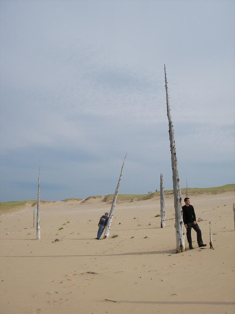
Above: This shot doesn't warrant inclusion without an explanation. Named for the foul smelling plants that covered the banks of the Chicago river prior to the European invasion, "Chicago" literally means "land of stinking onions" in the local Native American language (Illini? Miami?). This fence surrounds a ventilation shaft of some sort. If you follow the vertical poles down towards the sidewalk, you'll see that they seem to sprout from an onion-like bulb, representing the land of stinking onions that we all know and love.


Right: Me and The Gregory, Cubs v. Brewers, Millers Stadium, Milwaukee. Cubbies won. Holy cow.

Right: My father, John, cycling on the Fox River Trail.

Old friends.

Looks like the Sleeping Bear Dunes portion of my report will have to wait. It's simply too rich a subject to for today. We build up to things like that....

Friday, September 09, 2005

Ascent of Hiezan

Last Saturday I had the opportunity to climb Mt. Hiezan, a massive granite slab with numerous bolted multi pitch alpine routes. Though I've climbed (or attempted to do so) Hiezan twice in the past, I've always encountered difficulties. The first attempt went fine enough until summitting, at which point myself, Steve, and Kiara realized we couldn't hike down from there. With only two hours or less left of day light, we start to rappel, just barely making it off the mountain before absolute darkness set in. The second "expedition" didn't even make it to the top. While proud of myself for climbing a ballsy on-site lead, I was disappointed to find that I had veered far right of our intended route. With no choice (aside from bailing) other than to continue, Kiara led the next pitch. That too was ballsy, so at the second anchor we made the smart decision to get the hell out of there.

Flash forward 14 or so months, more experience (albeit sport climbing), and Mr. Isobe, our Japanese lead climber who knows the mountain backwards and forwards, having climbed there almost every weekend for the past five years. There was also Andrew in tow, a beginner who was being introduced to climbing on a 500 foot granite slab. Birth by fire so to speak. We were ready.

Our first climb started at 11am. Isobe-san led all the routes, flying up them at break neck speed as I belayed him. Andrew climbed second, thereby not having to belay at all. This route soon had a very deja vu feel to it, a theme that would last the entire day. I soon realized why. My present course, 3KN Slab, was the intended route for my second Hiezan trip, the route that I sub-consiously chose to ignore for a much more challenging difficult and dangerous route. I was kicking myself once I figured this out. 3KN is a sweet climb for any beginner, and with Isobe-san leading the way, I had an opportunity to really size up the route. Diagnosis: Kiara and I could have easily tackled this one. Live and learn.

After 6 pitches we were at the top, taking in the breathtaking view. Hiezan is in the Shishigawa Valley, one of the more rugged areas of Kyushu, with steep granite faces, crystal clear rivers, and mountains maxing out at 1600 meters. Until about 65 years ago, this area had a substantial logging industry, as is obvious by the abundance of cedar plantations throughout the valley. Oh how times change. The current population is about 70, with the vast majority of residents in the twilight years. While it's sad to see the community dwindle (they closed the elementary school last March after graduating their last seven students), I enjoy seeing the area return to nature. It probably hasn't known this much solitude since the start of the Meiji period.

After a brief lunch break at the top, we started hiking over the ridgeline to the trail down, definately a sketchy experience and scarier than the climb up. 45 minutes later, we were at a small shrine, filling up our water bottles from a mountain spring. That done, we headed to Slab #1, for our second and final ascent of Hiezan.

This route also felt familiar. After a brief searh of the archives, I discovered that this was the very first route I had ever attempted at Hie, the one we had to rappel down for want of a trail. I was a little nervous about this by the second pitch, but Isobe-san assured me that there was indeed a trail from the summit. Seven pitches, no falls, some aid climbing over one area, and there we were again, sitting on the top. None too soon either, as it started to rain on our last pitch. We were dead tired after a day of 13 pitches under a hot sun. Again, a brief snack, collecting the gear.... we were ready to go. Where was the elusive trail? Sure enough, it was there and obvious at that. Our mistake a year or so back was not looking over the rocks towards are right, a mistake that forced us to rap in almost darkness. Well, all's well that ends well.

Sunday, June 19, 2005

Ryutosen Swimming Area

Ryutosen is a series of waterfalls outside of Omura, Nagasaki-ken. The largest waterfall, called "Ryutosen" is about 30 feet tall. It feeds an extremely deep pool that must have been a cave that became a sink hole that became the pool that it is now. You can literally dive from the rock edge, a mere two inches aove the water, with no fear of injury. Several other pools and waterfalls also exist down river. All are deep and great for jumping.

My personal favorite is 25 foot jump that requires a running start. The catch is that you can't see the water from where you start your run. By the time you see the water, the wheels are in motion. To stop in mid sprint would only mean injury and your body seems to instinctively know this, though your mind is thinking "oh shit, oh shit, oh shit....". You're passed the the point of no return, so you do only what any sane person would: scream like a madman, gallop one last time, and fly. The adrenaline rush that occurs is undescribable; it reminds you that you are alive.

I'll try to get a photo of someone in action for a future posting. In the interim, here's a shot of Ryutosen on a foggy day, a bit of a surreal image if you've been there when the sun is shining.

Thursday, June 02, 2005


From Left: Harasaki-san, Kawachan, and the subject of this blog, Joe. Posted by Picasa